Hi Julie,
When I slept 5,600 m in the "high camp" I was only mildly uncomfortable. I think that the 3 days of hard riding at high altitude helped immensely.
Joy,
Yes, I was warm enough. I definitely used all of th "warm clothes" that I had. I did have to use additional clothes from the guide company ("Colibri"). I rented a heavy duty sleeping bag, and a thick gortex jacket, not to mention the standard climbing gear. Colibri is a type of hummingbird by the way.
Rags,
Yeah, enter me in the TR ... if and only if the payment isn´t due until the Spring. I don´t have a partner though. If payment is due before I get back forget it.
Jorge,
I have a contact in Santiago through a couple that I am good friends with (Yuri and Margarita). Their cousin lives in Santiago. She will receive the tarjeta de debito. She will be in the city for the next several weeks. Let´s stay in touch! Gracias de todas maneras.

Wednesday, October 31, 2007
Day 8, In Arica, Chile
First off the bike stats ... 6.5 hrs total time, 5.25 hrs ride time, 142 km, 810 m elevation gain AND 4,240 m elevation loss. I have completely descended from the Andes and am now in the most Northern city in Chile which is at sea level.
 What a change. It was absolutely fun to descend 4.2 vertical kilometers. However, I am quite exhausted.
Interestingly enough today was the first day that it was warm enough to completely ditch my leg and arm warmers, and gloves.
My energy level is a little down. Hopefully, tomorrow I will wake up with my mojo rejuvenated.
Tomorrow is the start of another big challenge - crossing the Northern Chile which is a desert in every nature of the word. I will have to carry enough food and water for the entire day. The objective is to reach the tiny "outpost" of Cuya, about 109 km from Arica. I will then fill my panniers again with pop, bottled water and a few snacks. I will most likely be pitching my tent somewhere in the sand. Wish me luck.
I will be out of contact until I reach Iquique which is 3 days from now.
Oh yeah, currently the prevailing winds are mostly towards the north. Precisely where I am headed. I am hoping that they change ever so slightly so that it is at least only a cross wind. The winds here are generally quite strong and play a HUGE role as to my progress and how knackered I feel at the end of the day.
By the way ... all of your messages are read and very much appreciated!!
Tuesday, October 30, 2007
Day 7, Putre, Chile
Was somewhat sad to leave Bolivia behind but I have to put as much pavement behind me as possible and now I am in the tiny village of Putre, Chile (about 2,000 habitants) which is nestled in the western side of the Andean mountains.
The ride today was only about 86 km. 6.5 hrs total time and 4.75 hrs ride time. Had to spent a lot of time leaving customs in Bolivia and entering Chile. Had tremendous head winds at times. To put things in perspective, I was riding downhill in my "granny gear" (small front chain ring). Oh yeah, I forgot, had 1,000 m of elevation gain with a maximum elevation of 4,665 m. Today I really went at a snails pace in spite of the fact that I was trying to do as many circles as I could with my little legs.
Am planning on a monster day tomorrow. Want to make it to the city of Arica which is about 150 km away. There is a lot of elevation loss but if the winds are strong and against me I will shut things down earlier. Vamos a ver lo que va a pasar. Let´s see what happens.
Will try to download a few "highlight" photos.
Days 3 to 6, Sajama
Day 3
Made it to the village of Sajama, again, in the high Andean Plains. It was kind of funny because as I reached the turn-off to the village of Sajama I let out a yelp, "Vamos!" because I was making such good time. However, my glee was short lived as the 11 km road was soft sand and I had to virtually push my bike the whole way. On the bright side ... I thought the road was 18 km so it wasn´t all that bad.
Later that afternoon I met up with my guide Sergio Israel. Chatted with a few other climbers and travellers from Switzerland. All was good.
Day 4, 5, 6 ... The "Attempt of Volcan Sajama"
This was a serious objective that I had, an attempt to climb the Volcan Sajama which is 6,542 m and the highest mountain in Bolivia. This was a 3 day venture.
Day 1 was quite easy, we reached "base camp" in after about 3 hours of hiking. Elevation was 4,800 m. We had the assistance of a bushy burro and two young arrieros (burro drivers).
Day 2 we ascended to the "high camp" in only about 3 hours and change. 5,600 m. OK, we did have a porter helping us as well, which is very common. However, the bad news was that all of the beautiful sunshine that we had created large quantities of moisture in the atmosphere from the Bolivian jungle. This is a common occurance this time of the year. Things really started to sock in.
Day 3 we woke up at just before 1 am ("Andean Start") only to find our route covered in mist and clouds. We went back to sleep. Go figure. However, by around 6 am there were some "breaks" in the clouds. We decided to get our butts out of the sleeping bags and to see how far we could ascend. The ascent was much more technical than I thought. We had to do a little ice climbing up a short 50 degree ramp. Was very cool because the ice formed kind of like a series of "shark fins" due to the wind. After the little ice climb we followed a ridge which was a little exposed at times and required a little bit of climbing. We were roped up the whole time. After the technical part was over we started to ascend the main open glacier to the summit, however, both time and the weather were against us.
At about 6,000 m the visibility was very poor. Up higher you could not see anything and below us there were grey threatening clouds everywhere. Retreat!
We went back down to the High Camp, packed up our gear and headed back to the village of Sajama. I must admit it, I was disappointed not to reach the summit but was very happy to at least have attempted the mountain and got past the technical sections. Oh well, next time.
The weather can change VERY quickly in this area. As we descened the entire region was covered in grey clouds with rain at the lower elevations and new fresh snow on all of the volcano peaks in the region. Things looked ugly. HOWEVER, go figure, the following day (Oct 30) it was clear again!
Thursday, October 25, 2007
Day 2, Curahuara de Carangas
Day 2 now complete. Pant, pant, pant. Today was tough. 103 km distance, 907 m elevation gain, again all day was spent riding across the undulating High Andean Plains the elevation varied from about 3,850 m to about 4,050 m. The vegetation consists of tufts of grass and sage brush like plants. Fortunately, I had enough food in my panniers and didn´t have to eat any. Had to fight some fierce head winds today. Total time was about 6.5 hours of which 5 hrs 10 min was riding. One flat tire today.
Before I complete this anecdote, remember there are about 3 million llamas in Bolivia.
OK, I´m riding down the highway, minding my own business when I ride by two llamas by the side of the highway. One of them got spooked and started to bolt across the highway. Just in that moment I hear a semi-trailer behind me. I lay on the brakes and go towards the ditch thinking that some carnage was about to happen. Spidey senses were unfortunately right. Fortunately, the llama died instantly. All I can say is that it was not a pretty sight. I was only meters away.
Am now in the village of Curuhuara de Carangas. I am staying in a very nice hostel. Very surprising we are in the middle of the Andean high plains. There was even a cold shower which I took advantage of.
One of the difficulties is getting enough food that is not bread, crackers, cookies or pop. I am hoping to eat some chicken or eggs tonight.
OK, this time, there will not be internet for a while. This was a BIG surprise. The people at this village seem much friendlier than the last one.
Day 1, Patacamaya
Day 1 on the bike is now complete. What a great feeling to make it to the first destination.
I am in a high Andean village called Patacamaya. About 3,850 m. A little chilly and blustery during the evenings.
The ride out of La Paz started with a big ascent of which at the start I was uncertain if I had the mustard to even ride it. I did ... slowly. It is a steep grade.
The basic stats for today were ... 107 km distance, 920 m elevation gain, total time about 6.5 hours of which I took about 1 hour for breaks. Most of the day was spent riding around 3,900 to 4,000 m. Lots of undulations. Was on my bike by 6:45 am. I wanted to avoid the traffic leaving La Paz.
Believe me, Patacamaya does not have a wide range of places to stay. Imagine a 1 star hotel and then down grade it a notch or two. That is where I am staying. Needless to say, I hope to start bright and early again tomorrow.
OK, internet access will be non-existant for several days. Still planning an ascent of Volcan Sajama. Vamos a ver como me va. We'll see how it goes.
Signing out for about 1 week. Until around Oct 31.
I did manage to lighten my equipment by about 10 grams. If you guessed that I left my debit card in a instant teller in La Paz you would be right. OK, it was very light headed moment. The instant tellers work differently here. Really confusing. I do have a credit card that also accesses my bank account. I can´t lose this last piece of plastic.
Tuesday, October 23, 2007
In La Paz, Bolivia
Got in very late this morning .... about 2 am but managed to get up early and assemble the bike and arrange for a little volcano climbing action. I met up with a great guiding agency to arrange for an attempt to ascend Volcan Sajama. I will attempt to ascend the volcano with the assistance of a guide (in about 4 days from now). After making the arrangements we played chess. He also teaches an academy of chess. Yes, I lost every game.
La Paz is very cool, at 3,640 meters what do you expect. Lots of hustle and bustle. Some locals were planning a strike in front of the main plaza. Met a nice fellow who just got out of jail for transporting coke (not coca-cola). Oh, 9 years in a Bolivian jail. I gave him a dollar. He was from the east Bronx.
OK ... tomorrow is SHOW TIME. First day on the bike. Please wish me well. Will try to leave La Paz no later than 7 am in order to avoid the congestion. I am in the middle of downtown.
I may or may not be able to get an internet connection. I will be crossing the cordillera Andes. This will take about 8 o 9 days (three of which will be used to attempt to climb Volcan Sajama).
Here is the route ... La Paz to Patacamaya to Curuhuara de Carangas to the village of Sajama. Then 3 days climbing the mountain. Then descend to the west to Chile! Yahooooooo. Internet connections will be extremely sparce.
Signing out for a few days.
Monday, October 22, 2007
In Transit
I will be arriving in La Paz, Bolivia late tonight. So far the trip has just be planes and stopovers. The cardboard bike box has taken a minor beating but the bike should be OK.
Have made arrangements to talk to a mountaineering guide company in La Paz. Might try an ascent of the Volcano Sajam. Vamos a ver (we will see).
Have made arrangements to talk to a mountaineering guide company in La Paz. Might try an ascent of the Volcano Sajam. Vamos a ver (we will see).
Wednesday, October 17, 2007
Downsized gear a little
Took Yuri's advice and left a few items behind. Am now down to about 52 lbs. Will jetison a few more items if need be.
Saturday, October 13, 2007
Successful Test Ride
Went for a short test ride this afternoon. It was asked if I have a support vehicle. Well, I wish that I did! The total weight of the gear is 59 lb. That does not include food and water. I took an additional 5 liters of water for the test ride. Total weight was about 70 lb. My initial reaction was hmmmm, this is heavy. The slightest of hills were difficult. Go figure!
On the plus side, all of the gear fit in the panniers with room to a little room to spare for food.
Of note: the total rated load of the pannier racks is 110 lbs.
On the plus side, all of the gear fit in the panniers with room to a little room to spare for food.
Of note: the total rated load of the pannier racks is 110 lbs.
Thursday, October 4, 2007
Subscribe to:
Comments (Atom)
Bristling winds at the "Fu"

Winds are from the West. If all holds true, hopefully, I will be faced with cross winds for the next 1000 km. However, today was all headwind.
This is Futaleufú, Chile

OK, it is tiny but its beautiful around here
Crossed into Chile on Dec 11

No problems crossing the border ... even smuggled in a tiny quantity of cheese.
Gravel rode riding towards Chile

This will be my last day in Argentina for a while .. until I hit the deep south
Riding towards Chile, Dec 11

Nice views of the snow covered Ande
These Andes form the border between Argentina & Chile

Riding on Dec 10th. Will be heading west and back into Chile through a mountain pass (Futaleufú) on Dec 11 ... if all goes well
South thru the Lake District, Dec 10

Beautiful ... but ferocious winds
Tiny Hostal in Epuyén, Dec 9

I was the only one there. It´s a little of the beaten track.
South of El Bolsón, Dec 9

Nice Lake District riding
Lake District with the Andes in the background

Nice riding all day long
Typical Lake District Riding

Very enjoyable riding. A little gusty at times though.
Just south of Bariloche, Argentina

The beautiful Lake District
Had a nice Argentinian style steak

I must say it was delicious. People have dinner around 10 pm (or later) around here. Also, from 1 pm to 5 pm most shops are closed.
Entering the town of Bariloche, Argentina

I was very interested in seeing this famous Patagonian city that I have heard so much about.
Riding along the lakeshore into Bariloche

Typical riding for day 44 into Bariloche. Thank goodness, I had a nice tail wind for most of the day.
Descent into Argentina

Was a little chilly. This was the ride from "El Crucero" to the beautiful village of Villa La Angostura. Was a long day. Stayed at a rustic Argentinian hostal.
Welcome to Argentina

As you can see there was plenty of snow at the top of the pass. Was a cold, windy, and rainy descent.
Heading East to Argentina, Day 43

The mountains in the background form the border with Argentina. Ended up passing through the mtns and descending this day.
Short Cut after "El Crucero"

Ended up flatting on this road. Bike could handle it but had to ride slowly .. about 16 to 18 km-hr
Waiting out the rain

Waiting out the rain at an antiquated rural bus stop (Day 41, 40 km out of Pucón)
Another view from the top of Lanin

I forgot to mention, the top of this mountain forms the border with Argentina. Our Guide, Rodrigo, demanded documents from the Argentians that arrived.
View from the Summit

Rodrigo making the final steps to the summit. View looking north along the Andean mtn range
Rodrigo ascending Lanin

My trusty guide leading the way
Villarica in the Shadow of Lanin

Getting close to the summit of Lanin
View of the High Camp

We ended up sheltering ourselves a little better by digging them out a little lower
Snow Caves

We each had our private rooms .. out of snow
Making dinner at the high camp

Rodrigo and Cristian from Rumbo Sur
Volcano Lanin

This is what we climbed
Valley of Yellow Flowers

These flowers only flourish in areas when volcanos have left behind ash or lava
Lake Toro (Huerquehue Park)

Mountains in the background are abou 10 km away from the Argentinian border
Snow on the Trail ... Huerquehue Park

The upper sections in the shade had snow. I thought I was escaping the snow.
Huerquehue Park (more)

Another nice lake
Huerquehue Park (close to Pucón)

One of the nice lakes
Countryside around Pucón

Lush green mountains and some open pastures
Villarica Volcano ... in the clouds

Thought I better take this photo in case the weather didn´t improve
Met two riders from Spain (Basque Region) on the way to Pucón

We ate trail mix together as part of the ritual between fellow cyclists
Villarica Volcano (look closely)

You have to look closely to make out the white cone and the cloud on top looks like an oriental hat!
Plaza de Armas at Temuco

One of the nicer plazas I´ve come across.
A Yellow Bridge and a nice valley.

You´ve heard of a yellow submarine right. Kind of the same?
Main Plaza at Mulchén

Nice place to sit and read for a few minutes
Hotel Mulchén

Very comfy. Didn´t have much time to enjoy at as I left this morning at 6 45 am.
Can you tell it was hot in Mulchén?

Dogs of Mulchén trying to escape the heat.
Locals Swimming at Mulchén

I later joined in the folly and took a dip. Proved to be a nice way to cool off on a hot day.
Bureo River at the village of Mulchén

Looks like clean water to me.
Typical riding close to the village of Mulchén

Around 500 km south of Santiago
Having a snack break

Pod asked, "what I´m on?", well, it is peanut butter, jelly, cheese and bread. And of course the awesome Chilean empanadas. Yum, yum. By the way, this was the first stop after 4 hrs straight riding.
Pit stop at a highway bus stop

Very convenient place to stop to take a quick snack break
Hostel in Chillán

Well, of course I had to stay at this one! .. truth is, it was full but the owners have another one across the street. Comfy & ... cheap.
Hostel in Linares

Got a little disorientated in this pueblo, ended up going for a long afternoon walk.
Plaza de Armas in Curicó

Here is aportion of the main plaza, this is a very quiet pueblo ... shhhhhhh, everybody seems to be having a siesta
At the Hostel in Curicó

In the atrium. This is a budget accomodation but very clean & comfy. By the way, I have started to make reservations in advance to avoid riding around town like a chicken with its head cut-off.
Roadside Fruit Stand
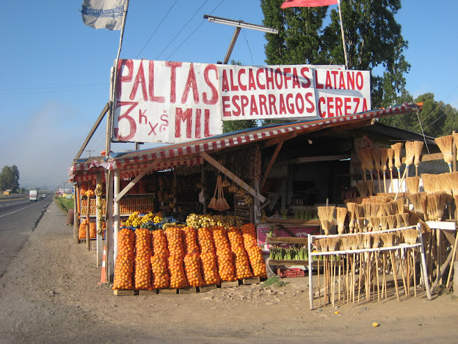
About 150 km South of Santiago. Fresh fruit & brooms for sale ... some type of "package deal" I suppose
LLama in Rancagua

Or was this an Alpaca? I don´t know but it was furry and cute.
Café con Piernas ("Coffee with Legs" in Santiago)

I am still trying to figure out why they call it that ..... great cup of coffee though
Sunset in Santiago

Yes, that is the Andes Mountains off to the East
Barrio (Neighborhood) "Paris London"

Just outside my Hotel enjoying a bit of the good life
Street vendors in Santiago

They were just selling books. This area is very close to the Univ. of Chile. I guess, this area has a high proportion of bookworms
One of the main streets in Santiago

I arrived on this street. It actually wasn´t too bad negotiating traffic.
Shoreline at Viña del Mar

I was kind of thinking that Chile was leaving their west flank wide open ... until I noticed these guns. Good on you Chile! Defend the beaches of Viña!
Pelican in Flight

I figure dogs shouldn´t dominate all of the animal photos.
More Chilean Coast

Very pleasant riding.
Chilean Coast, Day 28

I liked this yellow house
Village of Papudo

Unfortunately, I couldn´t enjoy the beach as I had to get the bike fixed
Welding (mechanical failure on Day 27)

Let´s hope that it "holds".
Preparing to Weld

Patrick & his helper Felipe
"Volker" from Germany

I met this other German solo cyclist, we had a coffee together, just after this photo he lit up a smoke before starting his ride. Must be a European thing.
Chilean Coast Close to Papudo

I liked this little cove
A Nice Beach 250 km North of Santiago

The highway is flanked by a barbed wire fence. If in a predicament, I think I could squeeze through and set up the infamous pup-tent.
Riding Along the Coast

By the way, the Panamerican is now a four-lane highway. It is in extraordinarily good condition.
Riding on the Panamerican Highway

The route between Termas and Los Vilos was constantly descending and ascending small valleys like this.
Trip Planning Over a Cappucino

This is where I nearly cried when I realized that I am still just scratching the surface.
Steets of La Serena

Just off the Main Plaza de Armas
Revelling in the Streets of La Serena

I think that this was a promotion for some theater. They seemed to be enjoying themselves though.
Back to the Chilean Coast

The city of La Serena is about 35 km south of this point along the coast
One BIG Tonka Toy

Mining is a HUGE industry in Chile. Gotta be real careful when you see one of these coming at you. As a matter of fact, there was a convoy of 3 lead by a police car about an hour later. I yielded.
Right in the Fog bank

Yes, at this point in time I quickly turned around and rode bank up to clear skies and waited until the fog burned off.
Fog Bank in the Valley

"La camachaca" is what they call this thick as pea soup (but tastes different) fog.
Early morning riding through the coastal range

The terrain has now changed and is supporting some vegation. Looks to me like something out of those Spaghetti Westerns with Clint Eastwood.
At the Pensión at Incahuasi

Little Simon is feeding the geese that were just outside my room.
Entering the Village of Incahuasi

As shown from the sign it appears that there is some woman who plays some strange shaped cello. Hmmm, I later learned that symbol meant Arts & Crafts. Learn something new every day!
Breakfast at the Posada

OK, I gotta come clean, this was my second breakfast of the day ... after about 2 or 3 hours of riding
Typical Posada along the Highway

This pooch was not interested in terrorizing gringos ... at least not in the early morning
Camping at Playa Flamenco

This little "Big Agnes Tent" has served me well so far. Oh, those yesteryears of Boy Scouts...
A little sunbathing at Playa Flamenco

Too chicken to go into the water though
Leaving the Atacama Desert

Had a nice descent here!
Dog Day Afternoon at Posada Bahía Taltal

And the next morning as I was leaving they were wide awake ... had to run the gauntlet. Didn´t get bit though. They seem to enjoy intimidating gringos.
Posada Bahía Taltal

Getting back to civilization!
Sunset in the Atacama Desert

It got chilly at night but nothing compared to a Canadian winter
Camping High in the Atacama Desert

I wished I had built the windbreak another 2 feet high. It got gusty!!
Typical Atacama Desert

It isn´t all flat. It was hot though!!
The Camera Fell before the timer went off ......

And here is how pi--ed off I got. (ps, large cavernous things are my nostrils)
Taking a break in the Atacama Desert

This was one of those time when pop leaked inside my panniers. I was not impressed.
Mano del Desierto by Mario Irarrazabal

The rest of the body apparently is another 300 m below the earth
The Main Promenade in Antofagasta

And the search was on for a hotel .. it sure took a while .... big Empanada convention going on?
Entering Antofagasta

fighting traffic ... shoulder check, signal, lane change left.
Sunset at Hornitos

just about beddy-bye time
Camping at Hornitos

Yes, I finally figured out how to use the auto-timer
More Camping at Hornitos

No charge for camping, just hide out behind this big rock
More Chilean Coast

another pleasant view from today´s ride
Chilean Pacific Coast

Enjoyable views during riding along the coast
Strange things at gas stations

Uncle and nephew from Argentina touring throughout S.A.
Camping along the Coast at Rio Loa

After nodding off I was kind of wondering about the high tide mark.
Northern Desert

Yes, it is flat and sandy
Darryl in Arica, Chile

behind me is the "muro" where the Chileans defeated the Peruvians in an infamous territorial battle
From Putre to Arica

This snaked all the way down to the valley below
Entering Chile

Leaving Bolivian border

Cholita guarding bike
Attempt of Sajama

High Camp

Ridge on Sajama

My Guide Sergio, up the ice ramp

Leaving Sajama behind
High Andean Plains

fixing a flat
Images from Bolivia

In Patacamaya.
Packing List (final)
